Field supervision
Technical supervision of drilling and geophysical teams with quality control, traceability and alignment to project objectives.


Technical accuracy for feasibility and safety
Geological, geotechnical and structural characterization to reduce uncertainty, assess risk and support engineering and mining decisions.
Overview
CCMENG integrates field surveys, drilling, geophysics, surveying and technical interpretation to characterize mineral deposits and their geological, geotechnical and structural controls.
Data is organized into clear maps, models and reports while preserving the methodological rigor required for resource estimates, pit parameters and engineering decisions.
Request a quote↗Applications
Technical supervision of drilling and geophysical teams with quality control, traceability and alignment to project objectives.
Regional and local characterization of lithology, structures and mineral occurrences to build a reliable deposit interpretation.
Discontinuity surveys, stability analysis, pit construction parameters and risk assessment.
Pit design and stability
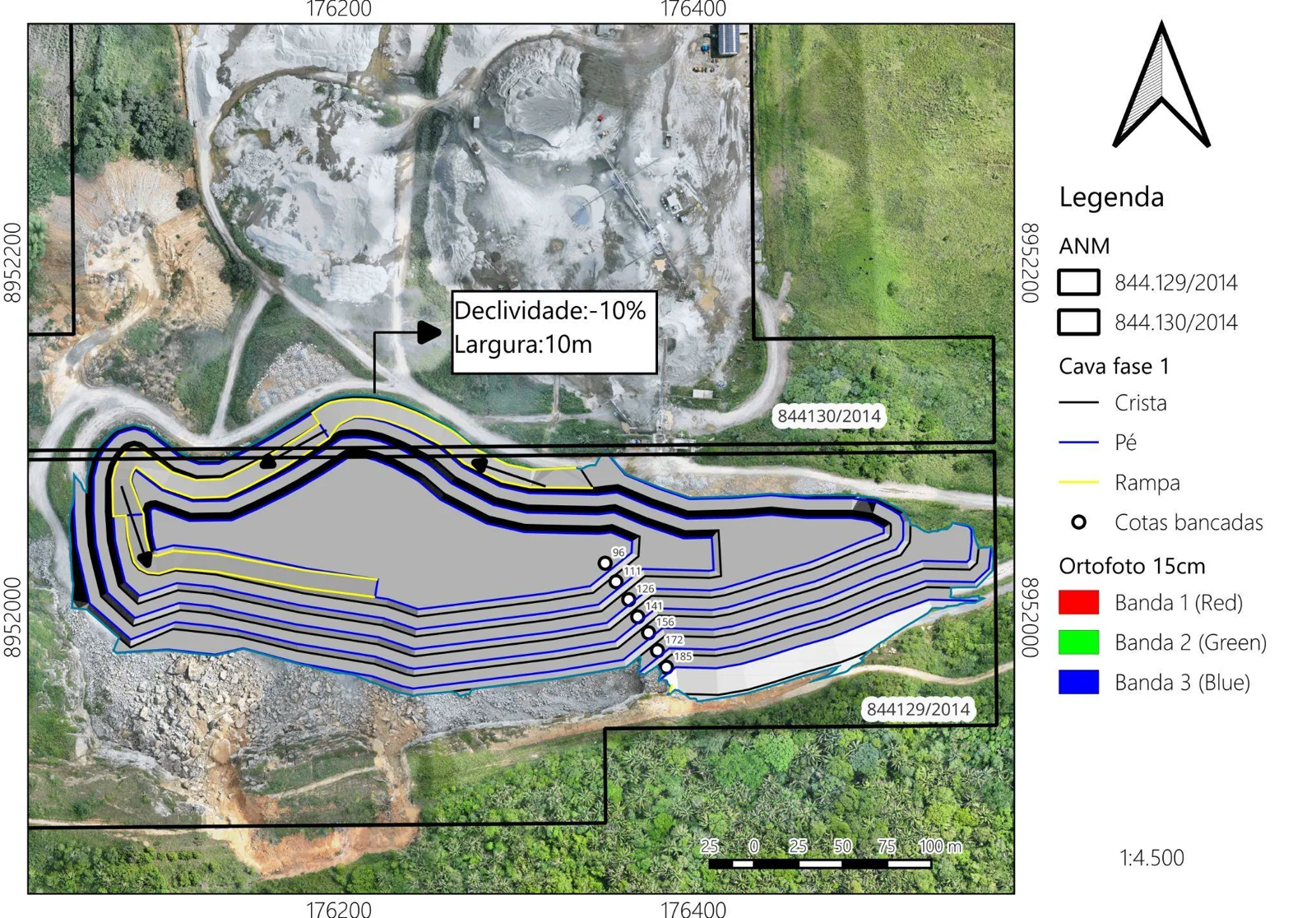
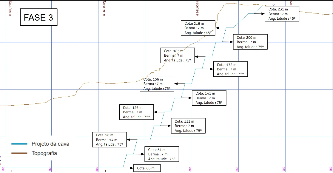
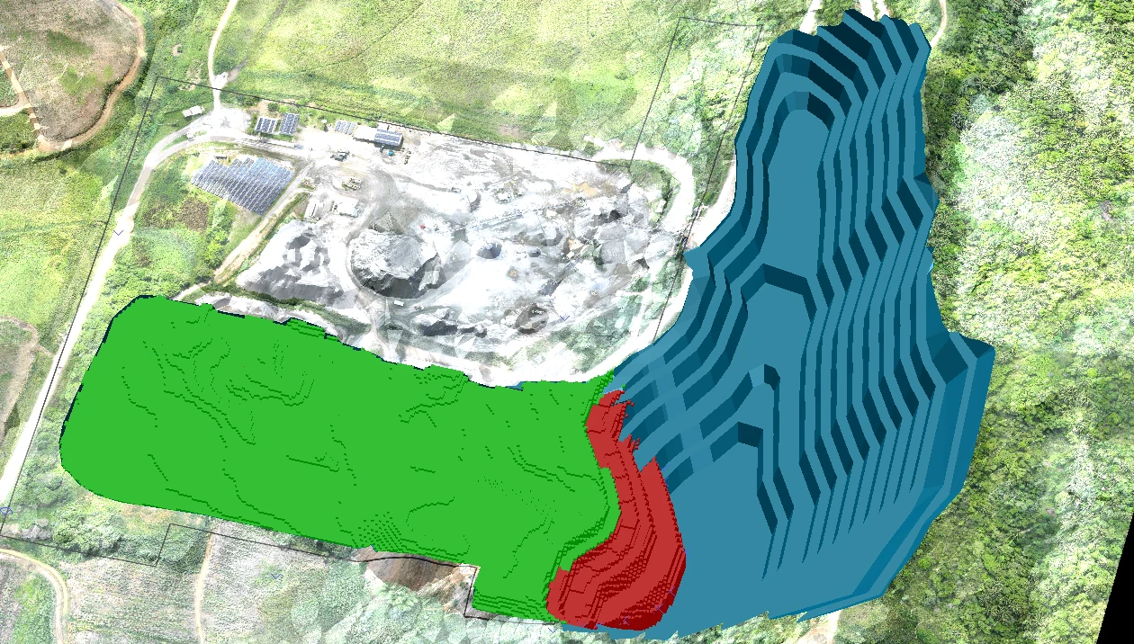
Plan view, slope redesign section and 3D model from a CCMENG technical study, communicating pit geometry, stability and expansion criteria.
What you receive
Let’s build together
Tell us about your project. CCM Engenharia is ready to understand your needs and recommend the next step.